Klamath National Forest
885 Trails
173 POIs
37 Peaks
24 Campsites
1 Picnic Site


Description
Straddling the California-Oregon border, this forest has part of five wilderness areas, 152 mi (245 km) of wild and scenic rivers, and 200 mi (320 km) of rivers for rafting, including on the Klamath River.The Siskiyou mariposa lily is endemic to the forest, being found nowhere else in the world.
Trails in the Hikepack map
- 14 North 17
- 14N 39
- 15N
- 15N 20
- 15N23
- 15N27
- 15N38
- 15N40
- 15W54
- 18N18
- 19N05
- 19N06
- 40S13
- 40S14
- 40S15
- 40S16
- 40S19
- 41S06
- 41S12
- 41S19
- 41S22
- 44N14
- 44N39Y
- 45N47
- 45N50
- 45N57
- 46N40
- 46N44
- 46N48
- 46N49
- 46N53
- 4812
- 48N21
- 77 Nf
- 9W02 & 9W60
- 9W16
- Abandonded? Not on 2004 USFS Trinity Alps Wilderness map
- Albert Lake Trail
- Beaver Creek Road
- Big Duck Lake Trail
- Bolam Road
- Bonanza Road
- Bull Gap Trail #1017
- Campbell Lake Loop
- Campbell Lake Trail
- Canyon Creek Trail
- Cedar Well
- Cherry Creek
- Cherry Maple Road
- Cliff Lake Trail
- Colestine Road
- Cottonwood Creek Road
- Cougar Creek
- County Road
- Deadwood Creek Road
- Deer Mountain Road
- Duck Lakes Trail
- Eaton Lakes Trail
- Eliza Gulch Road
- Elliot Creek Road
- Fen Trail (Kangaroo Lake)
- Foot Trail
- Forest Road 16N11
- Forest Route 14N21
- Forest Route 15N19
- Forest Route 15N32
- Forest Route 16N10
- Forest Route 17N23
- Forest Route 17N32
- Forest Route 40N01
- Forest Route 45N28
- Forest Route 45N49
- Forest Route 45N57
- Forest Route 46N27
- Forest Route 5E01
- Forest Route 5E02
- Four Corners Road
- Fox Creek Lake Trail
- Gilman Road
- Goosenest (from quarry) Trail
- Goosenest Lava Flow Overlook Access
- Goosenest North Rim route
- Goosenest Trail
- Grass Lake Fire Road
- Gravel Road
- Greenhorn Road
- Hogan Lake Trail
- Horeshoe Lake Trail
- Kangaroo Creek Road
- Kelsey Creek Trail
- Klamath Forest Route 41N18
- Little Applegate Road
- Little Duck Lake Trail
- Little Elk Lake Trail
- Long Bell Lumber Company Railroad
- Long Gulch Trail 9W14
- Long Prairie Road
- Lower Fire Road
- Luther Gulth Road
- Marley Gulch Trail
- Mavis Lake Trail
- McKinney Creek Road
- McLarty Road
- Mid Boulder Lake Trail
- Military Pass Road
- Mill Creek Road
- National Forest Development 40S11A
- National Forest Development 41S15 Road
- National Forest Development Road 40S01
- National Forest Development Road 40S06
- National Forest Development Road 40S11
- National Forest Development Road 40S12
- National Forest Development Road 40S16
- National Forest Development Road 41S15
- National Forest Development Road 4812
- National Forest Development Road 4812 Drive
- Orr Mountain Lookout Road
- PCT - California Section P
- PCT - California Section Q
- PCT - California Section R
- Pacific Crest Trail
- Pack Trail
- Paradise Lake Trail
- Paynes Lake Trail
- Red Rock Creek Trail
- Rogue River National Forest
- Scott Bar Road
- Shackelford Creek Trail
- Sky High Lakes Trail
- Skylight View Trail
- Soap Creek Ridge
- Soap Creek Ridge Road
- Split Rock Trail
- State Route 96
- Stewart Road
- Tail Gulch Trail 9W15
- Taylor Lake Trail
- Telephone Lake Trail
- Thompson Ridge
- Trail Gulch Lake Trail
- Trail Gulch Trail 9W15
- Trestle Road
- Tyler Gulch Road
- Unusable Delete??
- Unuseable Delete?
- Upper Cougar Fire Road
- Usf 45 North 04
- Usfs 42 N09
- Usfs 42 N12
- Usfs 42 N20
- Usfs 42 N22
- Usfs 42 N29
- Usfs 42 N70
- Usfs 43 N01
- Usfs 43 N03
- Usfs 43 N13
- Usfs 43 N20
- Usfs 43 N29
- Usfs 43 N35
- Usfs 43 N44
- Usfs 43 N46
- Usfs 43 N51
- Usfs 43 N52
- Usfs 43 N82
- Usfs 43 North 01
- Usfs 43 North 77
- Usfs 44 N 22 Y
- Usfs 44 N01
- Usfs 44 N01Y
- Usfs 44 N02Y
- Usfs 44 N03
- Usfs 44 N09
- Usfs 44 N10Y
- Usfs 44 N12
- Usfs 44 N12Y
- Usfs 44 N13
- Usfs 44 N15
- Usfs 44 N22Y
- Usfs 44 N23Y
- Usfs 44 N32Y
- Usfs 44 N33
- Usfs 44 N90
- Usfs 44 N93
- Usfs 44 N94
- Usfs 44 N95
- Usfs 44 N97
- Usfs 44 North 01
- Usfs 44 North 02
- Usfs 44 North 03
- Usfs 44 North 05
- Usfs 44 North 06
- Usfs 44 North 07
- Usfs 44 North 08
- Usfs 44 North 10
- Usfs 44 North 11
- Usfs 44 North 12
- Usfs 44 North 13
- Usfs 44 North 54
- Usfs 44 North 60
- Usfs 44 North 64
- Usfs 44 North 68
- Usfs 44 North 73
- Usfs 44 North 75
- Usfs 44 North 77
- Usfs 44 North 79
- Usfs 44 North 80
- Usfs 44 North 83
- Usfs 44 North 84
- Usfs 44 North 86
- Usfs 44 North 87
- Usfs 44 North 88
- Usfs 44N 95
- Usfs 45 N 08 Y
- Usfs 45 N 10 Y
- Usfs 45 N 11 Y
- Usfs 45 N 13 Y
- Usfs 45 N 14 Y
- Usfs 45 N 3 Y
- Usfs 45 N09
- Usfs 45 North 01
- Usfs 45 North 03
- Usfs 45 North 04
- Usfs 45 North 05
- Usfs 45 North 3
- Usfs 6P01
- Van Bremmer Lookout Number 2 Road
- White Drive
- Yreka Walker Road
Attractions in the Hikepack map
- Ananias Camp
- Back Meadows Springs
- Badger Mountain
- Badger Peak
- Bald Butte
- Bald Mountain
- Baldy Mountain
- Bare Mountain
- Bear Mountain
- Bear Paw
- Bear Peak
- Bear Wallow Peak
- Bearcat Mountain
- Bestville
- Big Red Mountain
- Big Rock Camp
- Black Marble Mountain
- Black Mountain
- Blue Mountain
- Blue Nose Bluff
- Boulder Peak
- Bowerman Peak
- Box Camp Mountain
- Browns Knob
- Buckhorn Bally
- Buckhorn Mountain
- Bull Gap
- Bullion Mountain
- Butler Mountain
- Butte Mountain
- Cade Mountain
- Campground
- Camping oak bottom
- Canyon Mountain
- Caribou Mountain
- Carter Meadows Summit
- Cecilville
- Cedar Mountain
- China Mountain
- China Peak
- Clear Creek
- Cold Spring
- Copper Butte
- Copper Mountain
- Cory Peak
- Cottage Grove
- Cougar
- Craggy Mountain
- Craggy Peak
- Crapo Mountain
- Deadman Point
- Deadwood Baldy Peak
- Dillon Creek Campground
- Dillon Mountain
- Doe Peak
- Dougherty Bluff
- Dry Lake Mountain
- Duck Lake Trailhead
- Eagle Peak
- Eagle Rock
- East Jerome Butte
- East Peak
- Eaton Peak
- El Capitan
- Elk Peak
- English Peak
- Erickson
- Etna Mountain
- Evans Mountain
- Ferry Point
- Figurehead Mountain
- Forks of Salmon
- Fort Goff
- Fort Goff Campground
- Foster
- Fourmile Butte
- Fourmile Hill
- Garner Butte
- Garner Mountain
- Goff Butte
- Gottsville
- Grant Bluffs
- Grizzly Butte
- Grizzly Peak
- Grouse Gap
- Grouse Hill
- Gunsight Peak
- Haight Mountain
- Hamburg
- Happy Camp
- Happy Camp Post Office
- Happy Camp/Oak Knoll Ranger District
- Haystack
- Haystack Butte
- Herd Peak
- Hill 22
- Hill 23
- Horse Creek
- Horse Mountain
- Horsethief Butte
- Hoskin
- Hotlum Sky Light
- Huckleberry Mountain
- Indian Creek Baldy
- Irving Mountain
- Jackson Gap
- Jackson Peak
- Kangaroo Lake Campground
- Kings Castle
- Klamath River
- Klamath River Post Office
- Lake Mountain
- Limestone Bluffs
- Little Baldy
- Little Cottonwood Peak
- Little Deer Mountain
- Little Grayback
- Little Horse Peak
- Little Medicine Mountain
- Little Preston
- Living Memorial Sculpture Garden
- Locked Gate
- Lookout Butte
- Lookout Mountain
- Lovers Camp
- Lower Devils Peak
- Mahogany Point
- Marble Mountain
- Mary Blaine Mountain
- McGavin Peak
- McKinley Mountain
- Medicine Mountain
- Merrill Mountain
- Middle Devils Peak
- Miller Mountain
- Montana Peak
- Monument Point
- Mount Ashland
- Mount Ashland Campground
- No Mans Mountain
- ONeil Creek Campground
- Oakbar
- Offield Mountain
- Parker Camp
- Parry's Market
- Paynes Lake Trailhead
- Penoyar
- Pigeon Roost
- Pluto's Cave
- Pony Peak
- Portuguese Peak
- Preston Peak
- Prospect Hill
- Pyramid Peak
- Red Hill
- Riverview
- Rock Creek Butte
- Rocky Knob
- Round Mountain
- Russell Peak
- Russian Peak
- Salmon Mountain
- Salmon River Outpost
- Sarah Totten Campground
- Sauerkraut Peak
- Sawyers Bar
- Scott Bar
- Scott Mountain
- Seaid Cafe
- Seaid Valley Store
- Seiad Valley
- Sharp Mountain
- Siskiyou Gap
- Siskiyou Peak
- Slater Butte
- Slinkard Peak
- Smith Hill
- Soft Water Spring
- Somes Bar
- Somes Mountain
- South China Mountain
- Spees Peak
- Squaw Peak
- Steelhead
- Stephens Butte
- Sterling Mountain
- Sugar Hill
- Sugarloaf
- Summerville
- Swiss Bar
- Tanners Peak
- Ten Bear Mountain
- Tennant
- The Lieutenants
- The Whaleback
- Three Sisters
- Tims Peak
- Toll Road Gap
- Tom Martin Peak
- Tom Payne Peak
- Tri-Forest Peak
- Twin Peaks
- Typhoon Mesa
- US Post Office
- Ukonom Mountain
- Ulcer Point
- Upper Devils Peak
- Vesa Bluffs
- Walker
- Wards Fork Gap
- West Haight Mountain
- Whisky Butte
- White Cloud Mountain
- White Mountain
- Whiteys Peak
- Wild Horse Mountain
- Wildcat Peak
- Willow Creek Mountain
- Wrangle Gap
- Yellow Dog Peak
Copyright
The PDF and JPG maps are released by Hikepack under the Creative Commons license Attribution-NonCommercial-NoDerivatives 4.0 International (CC BY-NC-ND 4.0)
https://creativecommons.org/licenses/by-nc-nd/4.0/.
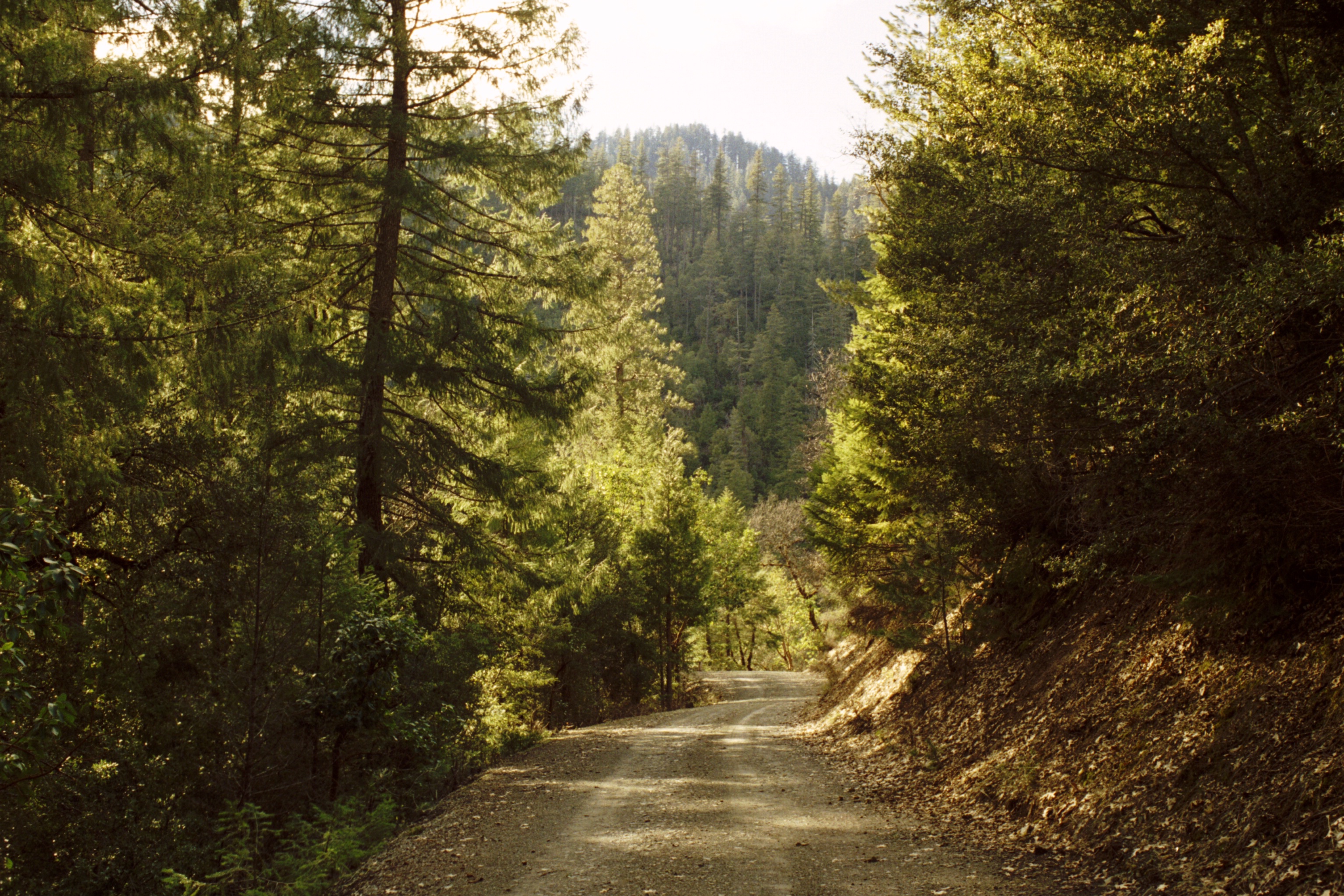
Contains data ©OpenStreetMap contributors (https://www.openstreetmap.org/copyright) under the Open Database License (https://opendatacommons.org/licenses/odbl/). Topographic map based on elevation data from Viewfinderpanoramas.org (Jonathan de Ferranti). Aerial imagery available from the U.S. Geological Survey. Description text is available under the Creative Commons Attribution-ShareAlike 3.0 Unported License from Wikipedia (https://en.wikipedia.org/wiki/Wikipedia:Text_of_Creative_Commons_Attribution-ShareAlike_3.0_Unported_License). Cover image ©Erik Wheaton https://upload.wikimedia.org/wikipedia/commons/0/0c/Klamath_National_Forest-16N05_March_05.jpg Public Domain