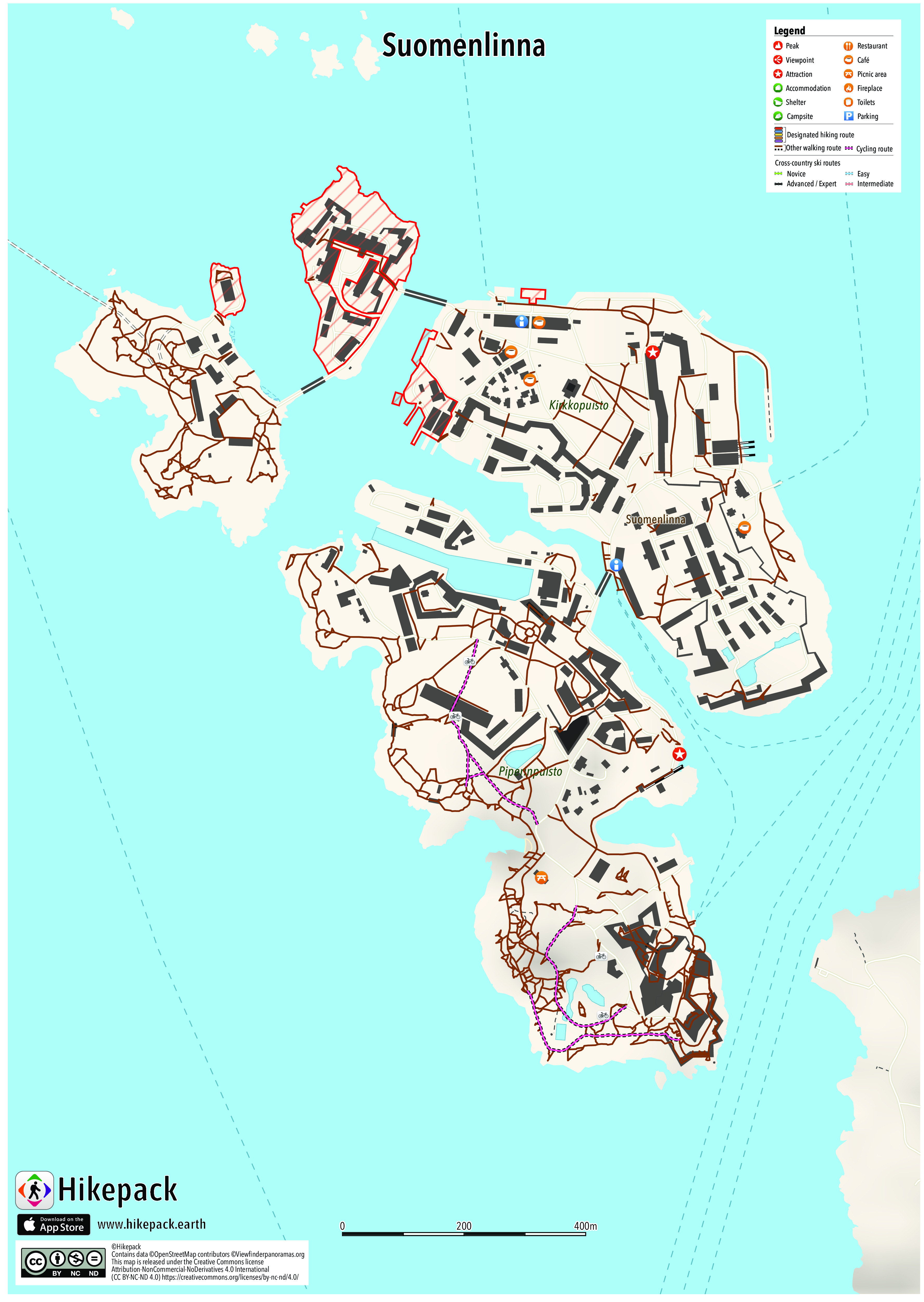
Suomenlinna
5 Trails
106 POIs
6 Cafés
3 Viewpoints


Description
Suomenlinna (Finnish), or Sveaborg (Swedish), literal translation Finland Castle, until 1918 Viapori (Finnish), is an inhabited sea fortress built on six islands and which now forms part of the city of Helsinki. Suomenlinna is a UNESCO World Heritage site and popular with tourists and locals, who enjoy it as a picturesque picnic site. Suomenlinna is now one of the most popular tourist attractions in Helsinki as well as a popular picnicking spot for the city's inhabitants. On a sunny summer day the islands, and in particular the ferries, can get quite crowded. In 2009, a record 713,000 people visited Suomenlinna, most between May and September. A number of museums exist on the island, as well as the last surviving Finnish submarine, Vesikko.
Trails in the Hikepack map
- Pikku mustasaaren silta
- Susisaaren silta
Attractions in the Hikepack map
- Bastion Bistro
- Bastioni Seth
- Cafe Piper
- Cafe Silo
- Café Jääkellari
- Café Vanille
- Ehrensvärd-museo
- K-market Suomenlinna
- Kahvila Samovarbar
- Kaponieeri Delvig
- Kruununlinna Ehrensvärd itäinen siipirakennus
- Kruununlinna Ehrensvärd keskiosa
- Lelumuseo
- Pizzeria Nikolai
- Puolibastioni Hjärne
- Ravintola Walhalla
- Sarvilinna Hessenstein
- Sotamuseon Maneesi
- Suomenlinna
- Suomenlinna Matkailuneuvonta
- Suomenlinna, huoltol
- Suomenlinna, huoltolaituri
- Suomenlinna, päälait
- Suomenlinna-museo
- Suomenlinnakeskus
- Suomenlinnan Upseerikerho
- Suomenlinnan kuivatelakan katseluterassi
- Suomenlinnan uimapaikka
- Suomenlinnan uimaranta
- Suomenlinnan vierasvenesatama
- Susisaaren Ruokala
- Tenalji von Fersen
- Tullimuseo
- Tykistölahden laituri
- Vesikko
- Vesiposti
- Viaporin Deli & Café
Copyright
The PDF and JPG maps are released by Hikepack under the Creative Commons license Attribution-NonCommercial-NoDerivatives 4.0 International (CC BY-NC-ND 4.0)
https://creativecommons.org/licenses/by-nc-nd/4.0/.
Contains data ©OpenStreetMap contributors (http://www.openstreetmap.org/copyright) under the Open Database License (https://opendatacommons.org/licenses/odbl/). Topographic map based on elevation data from Viewfinderpanoramas.org (Jonathan de Ferranti). Contains data from the National Land Survey of Finland Topographic Database 02/2018 (NLS orthophotos) CC BY 4.0 (http://www.maanmittauslaitos.fi/en/opendata-licence-cc40). Contains data from the National Land Survey of Finland Topographic Database 10/2018 (MAASTOKARTTASARJA (RASTERI)) CC BY 4.0 (http://www.maanmittauslaitos.fi/en/opendata-licence-cc40). Description text is available under the Creative Commons Attribution-Share Alike 3.0 Unported License from Wikipedia https://fi.wikipedia.org/wiki/Wikipedia:Creative_Commons_Attribution-Share_Alike_3.0_Unported_-lisenssiehdot. Cover image ©Michal Pise https://commons.wikimedia.org/wiki/File:Suomenlinna.jpg CC BY 2.0 (https://creativecommons.org/licenses/by/2.0/).